An 1860’s plan to deepen and widen rivers in the town was considered ‘fanciful’ by some, but was the real reason money?
The grand Newton Abbot market rebuilding scheme was completed by the Wolborough Local Board in 1871 at a cost of £15,000. This was a major town centre project that included various new buildings, a new road linking the market with Courtenay Street and, sadly, covering over the river Lemon. Who hides a river? Surely, most towns and cities see their river – if they have one – as a major asset.
The Wolborough Local Board – constituted under the Local Government Act 1858 – was essentially the ‘town council’ of its day.
The development arose from a public competition in 1867 to come up with plans for the new market area, and the following is of particular interest to me:
Some of the architects competing sent in fanciful designs providing for the deepening and widening of both the rivers Teign and Lemon, and the extension of the Newton Quays right up to the Market, and shewing ships discharging their cargoes right into the market buildings!
A.J.Rhodes, Newton Abbot: Its History and Development, c.1904
What I would like to know is this: why was such a plan considered fanciful? I think it more likely that the plan that was chosen, and which we still live with today, was less expensive. But – just for a moment – imagine how pleasant the town centre might be with a river and gentle sloping banks, seating and flower beds. And I have a further question: why has such a plan never been considered since?
One of the best-known new buildings in the development was the Newton Abbot Corn Exchange, but instead of its intended use it became a community meeting hall and from 1883 the Alexandra Theatre – as it is still known to this day.
As ever, click on an image to enlarge.

Above is a detail from one of 15 maps of Newton Abbot at 1:500 scale published by the Ordnance Survey in 1888. Circled in orange is the location of the Post Office at the time. Sherborne flour mill is at the top centre at the end of Mill Lane, which later became Halcyon Road. The Mill was demolished in the 1930’s.
The Alexandra Hall meeting place would have been used as a theatre by now and the Market House is better known as the Butter or Pannier Market. The Vegetable and Fish markets were opposite, in the south-east corner of this map.
To the north of the Pannier Market are gardens which, in the true spirit of ‘progress’ is now the multi-storey car park. Riverside gardens anyone?
Of great interest to me is the River Lemon which, from 1871, was covered over for the length of Market Street from Alexandra Hall, but which remained open along the course of what is now Sherborne Road with all of its bus stands.
Incidentally, you can clearly see in the map margin Wolborough (Newton Abbot) to the south of the Lemon and Highweek (Newton Bushell) to the north of the river, the ancient dividing line between the two towns of old.
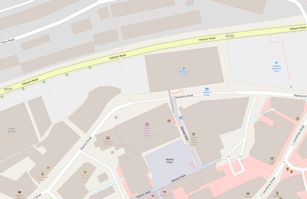
Pictured below is the map of today (2025) – with no hint of river!

Any thoughts? Leave a comment!