Newton Abbot in historic maps
I like maps; and have done so probably since pre-teen years. I suspect the main reason is perhaps I am inherently an explorer, which also explains why I am not, for example, a beach or package holiday person. Maps enable and facilitate exploration of towns, cities and countryside. Historic maps enable the mind to wander through – explore – the geography of the past.
I have a collection of atlases at home: Atlas of the Celts, Historical Atlas of South West England, Maps of Victorian Devon – and many others. As an energy, climate change and sustainability professional I have set up Geographic Information Systems in the local authorities I worked for.
So, given my interest in geography and maps it is hardly surprising that I love exploring historic maps. In articles on this page I will take a series of short dives into maps to reveal the history of Newton Abbot.
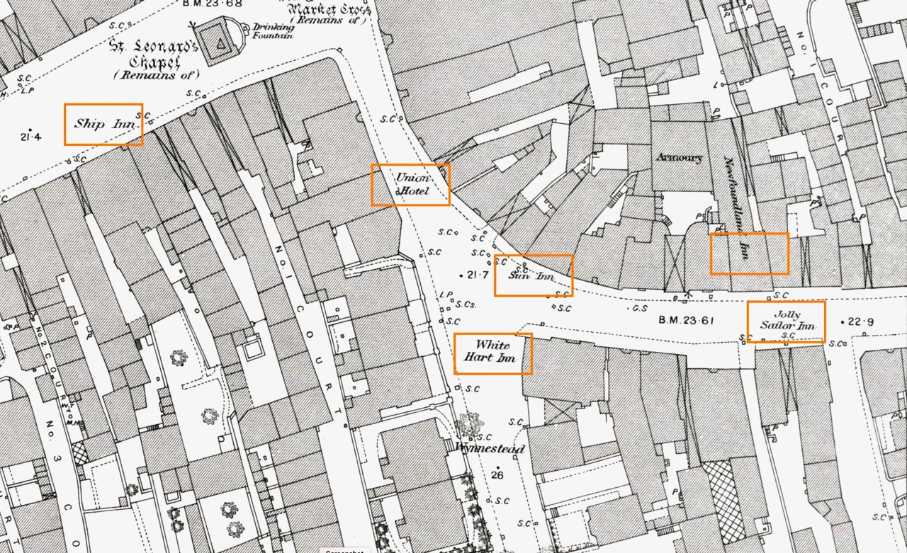
The map above is part of 1 of 15 maps of the Newton Abbot urban area, surveyed in 1888, showing St.Leonard’s Tower and lower East St.
Sources
To start with I shall focus on the Ordnance Survey Town Plans of the 1840s to 1890s. Newton Abbot was surveyed in 1888 and 15 maps of the urban area were published at a scale of 1:500.
Maps are available from the National Library of Scotland.
From the blog
-
Newton Abbot in Old Pictures: The Globe Hotel in 1981
The Globe was a fine hotel. Wouldn’t it be nice if the ground floor, which was a restaurant and bar, was the same today? Mr.Austin take note…
-
Post-war OS maps released showing Newton Abbot in detail in 1956
Can you remember where the Odeon was? Or Wolborough hospital? Maps from 1956 tell many a story…
-
Newton Abbot: How did Newfoundland Way get its name? And whatever became of The Sun Inn? East Street in 1888
How did Newfoundland Way get its name? And whatever happened to the Sun Inn? The lower end of East Street looked very different in 1888.
